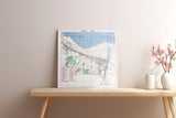
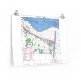
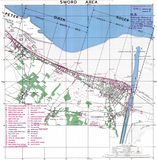
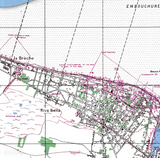
The British 3rd Infantry Division’s landing sectors at Hermanville and Lion-sur-Mer.
This original defensive overprint map depicts Sword Beach, the easternmost of the five Allied landing beaches during the Normandy invasion on 6 June 1944. The map details the Roger and Queen sectors, showing known German defensive positions, including machine-gun nests, anti-tank guns, and beach obstacles, as well as annotated terrain features inland from the beachhead.
Used by Allied planners and assault commanders in the lead-up to D-Day, this map provided essential intelligence for the British 3rd Infantry Division’s assault — supported by commandos of the 1st Special Service Brigade — between Hermanville-sur-Mer and Lion-sur-Mer. The precision and detail of the overprint make it one of the most significant cartographic records of the Normandy landings.
Product Details:
-
Printed on 175 gsm premium fine-art paper
-
Matte finish for an authentic archival look
-
Created from high-resolution scans of original wartime maps
-
Displays defensive positions, terrain features, and landing sectors
-
Ideal for collectors, historians, educators, and battlefield visitors
-
Ships worldwide in protective packaging
A faithful reproduction of the Sword Beach defensive overprint — capturing the planning and precision behind the British landings that anchored the eastern flank of the Normandy invasion.


