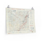
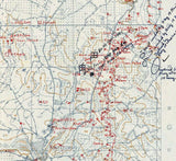
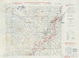
The battle for the Hitler Line in the Liri Valley.
This detailed Defence Overprint map, produced at a scale of 1:25,000, depicts the fortified region around Pontecorvo and Aquino — key positions along the Hitler Line (later renamed the Senger Line). The map outlines enemy defensive structures, minefields, and terrain features used by the German Army to block the Allied advance toward Rome.
In May 1944, the I Canadian Corps, supported by British and Polish formations, launched the assault that finally broke through this formidable defensive barrier. The fighting around Pontecorvo was intense and costly, marking a crucial phase of the Italian Campaign that led directly to the liberation of Rome.
This authentic reproduction preserves the detail and clarity of the original wartime map once stamped “SECRET”, offering a rare view into the planning of one of the final battles in the Liri Valley.
Product Details:
-
Printed on 175 gsm premium fine-art paper
-
Matte finish for a true archival appearance
-
Created from high-resolution scans of original wartime maps
-
Displays fortified positions, roads, terrain contours, and key battle areas
-
Ideal for collectors, historians, educators, and battlefield visitors
-
Ships worldwide in protective packaging
A faithful reproduction of the operational map used by Allied planners to assault the Hitler Line — a pivotal moment on the road to Rome.


