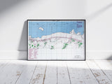
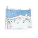
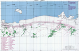
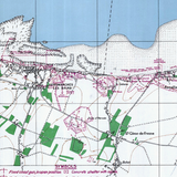
The British 50th Infantry Division’s landing sectors at Arromanches and Le Hamel.
This original defensive overprint map depicts Gold Beach, one of the five Allied landing beaches during the Normandy invasion on 6 June 1944. The map details the ITEM, JIG, and KING sectors, showing known German defensive positions including machine-gun nests, anti-tank emplacements, and beach obstacles.
Used by Allied planners in the lead-up to D-Day, this map provided essential intelligence for coordinating the British 50th Infantry Division’s assault between Le Hamel and Ver-sur-Mer. The map’s precision and annotations make it one of the most distinctive visual records of the Normandy landings.
Product Details:
-
Printed on 175 gsm premium fine-art paper
-
Matte finish for an authentic archival look
-
Created from high-resolution scans of original wartime maps
-
Displays defensive positions, terrain features, and landing sectors
-
Ideal for collectors, historians, educators, and battlefield visitors
-
Ships worldwide in protective packaging
A striking reproduction of the Gold Beach defensive overprint — capturing the challenges faced by British forces as they stormed ashore on D-Day to begin the liberation of Western Europe.


