The Italian battle that became Canada’s “Little Stalingrad.”
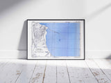
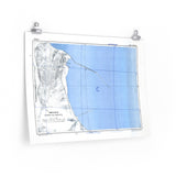
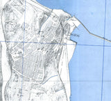
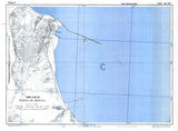
This detailed town plan of Ortona depicts the coastal city and harbour as they appeared during the fierce fighting of December 1943. The map was used to navigate the narrow streets and fortified buildings that defined one of the most intense urban battles of the Italian Campaign.
From 20 to 28 December 1943, the 1st Canadian Infantry Division fought against elite German paratroopers of the 1st Parachute Division in brutal house-to-house combat. Every street and building became a battleground as Canadian troops advanced through the shattered port, securing victory at tremendous cost.
This facsimile preserves the precision and clarity of the original wartime document, offering a unique window into the battlefield geography of one of Canada’s most hard-fought victories in the Second World War.
Product Details:
-
Printed on 175 gsm premium fine-art paper
-
Matte finish for a true archival look
-
Created from high-resolution digital scans of original wartime maps
-
Displays Ortona’s streets, harbour, and defensive structures
-
Ideal for collectors, historians, educators, and battlefield visitors
-
Ships worldwide in protective packaging
A striking reproduction of the map that guided Canadian forces through the deadly streets of Ortona — a defining moment in the Italian Campaign.


