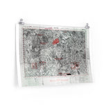
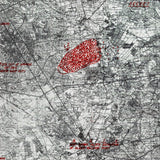
The Screaming Eagles’ glider landing zones south of Eindhoven.
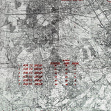
This detailed map shows the glider landing zones of the 101st Airborne Division during Operation Market Garden, September 1944. The map covers the area around Eindhoven, illustrating the designated landing zones, surrounding terrain, and data on Troop Carrier Squadrons—including which gliders successfully arrived and which went missing during the operation.
Operation Market Garden was the largest airborne operation of the Second World War, aiming to secure a series of key bridges in the Netherlands and open a path into Germany. The 101st Airborne Division’s mission was to capture bridges over the Wilhelmina Canal and hold the vital corridor to Eindhoven.
This authentic reproduction preserves the fine technical detail and annotations of the original U.S. Army Air Force glider operation map, offering a rare look at one of the most daring airborne missions in military history.
Product Details:
-
Printed on 175 gsm premium fine-art paper
-
Matte finish for an authentic archival look
-
Created from high-resolution scans of original wartime maps
-
Displays drop zones, flight paths, terrain, and unit information
-
Ideal for collectors, historians, educators, and battlefield visitors
-
Ships worldwide in protective packaging
A faithful reproduction of the map used to guide the 101st Airborne’s glider landings during Operation Market Garden — a key piece of the story behind the battle for Eindhoven and “Hell’s Highway.”


