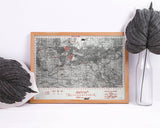
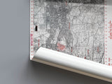
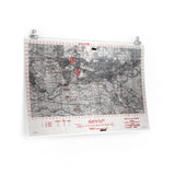
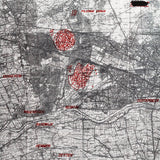
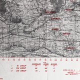
The British 1st Airborne Division’s glider and parachute landing zones at Arnhem.
This map shows the drop and landing zones of the 1st British Airborne Division during Operation Market Garden, September 1944. It details the locations where paratroopers and gliders of the division landed to secure the bridges around Arnhem — the northernmost objective of the Allied advance into the Netherlands.
Marked with precision by the Air Troop Carrier Command, the map outlines the planned flight paths, unit drop zones, and surrounding terrain, offering a detailed visual record of the airborne operation famously remembered for the Battle of Arnhem — “a bridge too far.”
This reproduction retains the fine linework and operational markings of the original “SECRET” map used for the airborne planning phase, making it an essential piece for those studying the largest airborne operation of the Second World War.
Product Details:
-
Printed on 175 gsm premium fine-art paper
-
Matte finish for an authentic archival look
-
Created from high-resolution scans of original wartime maps
-
Displays drop zones, flight paths, terrain features, and unit designations
-
Ideal for collectors, historians, educators, and battlefield visitors
-
Ships worldwide in protective packaging
A rare reproduction of the planning map used for the British 1st Airborne Division’s drop near Arnhem — capturing the ambition and sacrifice of one of the war’s most daring operations.


