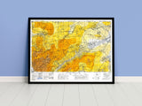
Visualizing the terrain of one of Normandy’s fiercest battles.
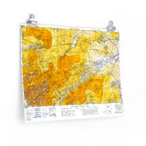
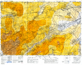
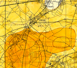
This hand-coloured topographic map of the Cheux area was produced in 1944 and found in a Canadian Army war diary. Each contour interval was meticulously painted to create a watercolour hillshade effect, helping commanders and staff visualize the elevation and shape of the ground.
The map depicts terrain that saw intense fighting west of Caen during the Battle of Normandy, where Allied forces struggled across open fields and rising ground under heavy fire. Both a tactical tool and a work of art, it highlights the importance of terrain understanding in the planning and execution of operations.
Product Details:
-
Printed on 175gsm premium fine-art paper
-
Matte finish for an authentic archival appearance
-
Created from high-resolution scans of the original 1944 hand-coloured map
-
Shows the detailed contours and elevations of the Cheux area
-
Ideal for collectors, historians, educators, and battlefield visitors
-
Ships worldwide in protective packaging
A vivid reproduction of the Cheux hillshade map, capturing the terrain that shaped the Canadian Army’s advance through Normandy.


