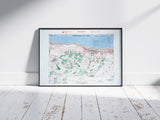
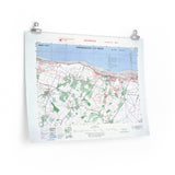
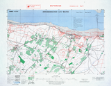
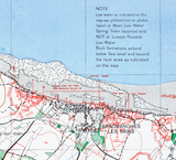
German inland fortifications opposing the British 50th Infantry Division’s landing zone.
This defensive overprint map provides an in-depth view of the terrain and German fortifications surrounding Arromanches-les-Bains, part of the Gold Beach sector of the Normandy invasion. Produced at a scale of 1:25,000, it extends further inland than standard beach overprints, revealing a complex network of bunkers, anti-tank positions, artillery sites, and roadblocks forming the defensive belt behind the coast.
Used by Allied intelligence in preparation for Operation Overlord, this map highlights the depth and strength of the German positions facing the British 50th Infantry Division as they advanced inland from the beaches toward Bayeux. Its precision and detail make it a rare and valuable record of the German defensive system on D-Day.
Product Details:
-
Printed on 175 gsm premium fine-art paper
-
Matte finish for an authentic archival look
-
Created from high-resolution scans of original wartime maps
-
Displays fortified positions, terrain features, and inland defences
-
Ideal for collectors, historians, educators, and battlefield visitors
-
Ships worldwide in protective packaging
A distinctive reproduction of the Arromanches-les-Bains defensive overprint, documenting the inland fortifications that opposed the British landings on Gold Beach.


