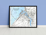
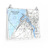
Mapping the liberation of the Channel Ports.
This original wartime town plan was produced to support the 3rd Canadian Infantry Division during Operation Wellhit, the battle to liberate Boulogne-sur-Mer in September 1944. The map was used to coordinate urban fighting and the clearance of German defences as Canadian forces worked to secure France’s Channel ports.
A detailed record of the battle for Boulogne, this reproduction highlights the precision mapping and intelligence work that supported Canada’s advance through Northwest Europe.
Product Details:
-
Printed on 175gsm premium fine-art paper
-
Matte finish for an authentic archival look
-
Created from high-resolution scans of the original wartime map
-
Shows urban detail and terrain features used by Allied planners
-
Ideal for collectors, historians, educators, and battlefield visitors
-
Ships worldwide in protective packaging
A striking reproduction of the Boulogne Town Plan — a reminder of the careful planning and courage behind the Canadian victory at the Channel ports.


