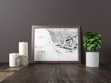
The liberation of one of France’s key Channel ports.
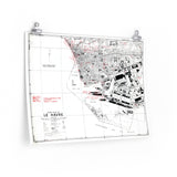
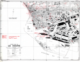
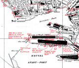
This detailed town plan of Le Havre was created to assist Allied forces during the assault and liberation of the city in September 1944. As part of Operation Astonia, the British 49th (West Riding) Infantry Division and the 51st (Highland) Infantry Division fought to clear the German garrison and reopen the port for Allied use.
Town plans such as this provided crucial tactical awareness for commanders and engineers, showing streets, key buildings, defensive positions, and infrastructure vital to urban operations.
Product Details:
-
Printed on 175gsm premium fine-art paper
-
Matte finish for an authentic archival appearance
-
Created from high-resolution scans of the original wartime map
-
Displays urban layout, key landmarks, and tactical features
-
Ideal for collectors, historians, educators, and battlefield visitors
-
Ships worldwide in protective packaging
A precise reproduction of the Le Havre Town Plan, offering insight into the challenges of urban warfare and the strategic importance of France’s Channel ports in the closing months of 1944.


