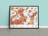
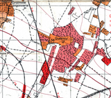
Terrain analysis for armoured movement along the Caen–Falaise highway.
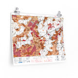
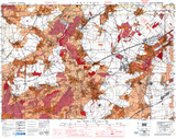
This original “Going Over” map was produced to assist Allied commanders in evaluating terrain for armoured and vehicle movement during the late stages of the Normandy Campaign. Using shades of red and orange, the map highlights areas where vehicles would encounter difficult or impassable ground, allowing planners to assess mobility and approach routes before major operations.
Centred on Potigny, along the Caen–Falaise highway, this map was likely referenced during Operations Totalize and Tractable, when Canadian and British armoured units advanced south toward closing the Falaise Gap. It stands as a rare example of specialized cartography designed specifically for operational planning.
Product Details:
-
Printed on 175gsm premium fine-art paper
-
Matte finish for an authentic archival appearance
-
Created from high-resolution scans of the original 1944 map
-
Displays mobility gradients, terrain restrictions, and tactical features
-
Ideal for collectors, historians, educators, and battlefield visitors
-
Ships worldwide in protective packaging
A unique reproduction of the Potigny Going Over Map, offering a striking insight into how terrain intelligence shaped Allied armoured strategy in Normandy.


