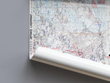
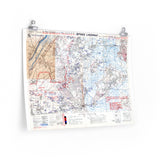
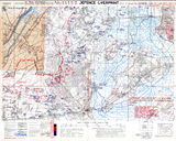
Depicting German defences opposing the British 6th Airborne Division.
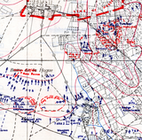
This original defence overprint map of the Troarn area shows the German defensive network guarding the eastern flank of the Normandy landings. On 6 June 1944, elements of the 6th Airborne Division dropped into this region to destroy key bridges, secure crossings over the River Dives, and hold the flank against counterattacks.
The map details enemy positions, strongpoints, and obstacles that opposed the British and Canadian troops advancing east of Caen. It offers a rare view of the defensive layout confronting the airborne and ground forces tasked with protecting the Allied left flank on D-Day.
Product Details:
-
Printed on 175gsm premium fine-art paper
-
Matte finish for an authentic archival appearance
-
Created from high-resolution scans of the original 1944 defensive overprint
-
Displays detailed German positions, trench lines, and fortified areas
-
Ideal for collectors, historians, educators, and battlefield visitors
-
Ships worldwide in protective packaging
A historically rich reproduction of the Troarn defence overprint, capturing the formidable defences encountered by the 6th Airborne Division on D-Day.


