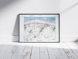
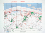
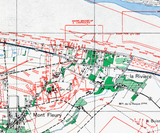
German coastal fortifications opposing the British 50th Infantry Division’s landings.
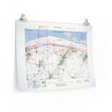
This defensive overprint map depicts the fortified coastline surrounding Ver-sur-Mer, on the eastern edge of Gold Beach, where elements of the British 50th Infantry Division came ashore on 6 June 1944. Produced at a scale of 1:25,000, the map details bunkers, anti-tank guns, minefields, and trench systems, extending from the beach inland to the first German defensive belt.
Compiled from aerial reconnaissance and intelligence reports, this map would have been used by Allied planners to identify strongpoints and fields of fire before the assault. Its detailed overprint highlights the strength and complexity of the German coastal defences that awaited the assault troops advancing from the surf toward Creully and Bayeux.
Product Details:
-
Printed on 175 gsm premium fine-art paper
-
Matte finish for an authentic archival look
-
Created from high-resolution scans of original wartime maps
-
Displays fortified positions, terrain contours, and inland obstacles
-
Ideal for collectors, historians, educators, and battlefield visitors
-
Ships worldwide in protective packaging
A striking reproduction of the Ver-sur-Mer defensive overprint, illustrating the formidable German positions guarding the eastern end of Gold Beach during the D-Day landings.


